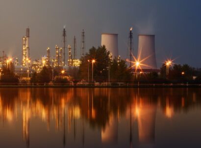
Overview
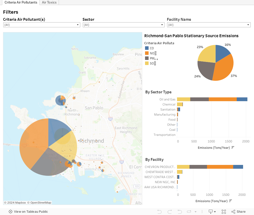
This mapping tool visualizes emissions data (criteria air pollutants and air toxics) from permitted facilities in Richmond-San Pablo, California. Users can select individual facilities, view their reported emissions, and filter and compare the results by pollutant, facility, and sector type.
Quick Tips
- To explore each map: Select one of the tabs on top.
- For best visualization: Click on the full-screen icon at the bottom right corner.

- To display relevant tooltip data: Select or hover over individual facilities and census tracts.
- To customize your results: Adjust filter criteria, search by facility name, click on legends or plots.
- Zooming in and out: Use your mouse or the buttons that appear when you hover in the top left corner.
- To download data from an individual plot or map: Click on the map/plot of interest and then click on the download icon at the bottom right.

- To undo all filters: Click on the reset icon at the bottom right corner of the map.

- To embed or share a link to a specific map view: Click the connections icon in the bottom right corner.

- To re-center maps: Click on the home icon, which appears when you hover in the top left corner.

- For details on the data and methodology: Please refer to the Notes below.
Richmond-San Pablo Stationary Source Emissions Inventory
Notes
- The database of permitted facilities and reported emissions used in this visualization was compiled using the California Air Resources Board’s (CARB) Facility Search Engine. The data shown is for 2019. Annual emissions are reported to the California Air Resources Board through the Criteria Pollutant and Toxics Emissions Reporting (CTR) Program.
- NOX = nitrogen oxides (reported as equivalent amounts of NO2); SOX = sulfur oxides (reported as equivalent amounts of SO2); CO = carbon monoxide; PM2.5 = particulate matter less than or equal to 2.5 microns in diameter.
- Criteria air pollutants are six common air pollutants regulated by the US Environmental Protection Agency (EPA). They are the only air pollutants with National Ambient Air Quality Standards (NAAQS) that define allowable concentrations in ambient air. The six criteria pollutants are CO, SO2, NO2, PM, ozone (O3) and lead (Pb). Lead is shown here in the Air Toxics tab, as reported in CARB’s facility emissions inventory.
- Air toxics, or toxic air pollutants, are air pollutants for which exposure may be associated with adverse health effects.
- This inventory only covers emissions from permitted facilities and does not include other key area-wide sources of PM, like fugitive dust and residential wood combustion.
Contact Us
For questions, comments, or to report any errors in the data, please email Lee Ann Hill at lhill@psehealthyenergy.org. These data are accurate to the best of our knowledge, but there may be discrepancies in data aggregated from multiple sources and or errors introduced during the compilation. We would appreciate your feedback.